|
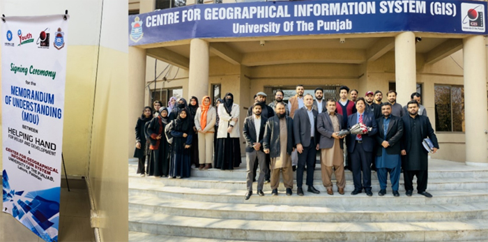
In a significant step towards enhancing youth empowerment, climate resilience, and community service initiatives, the Centre for Geographical Information System (CGIS) at the University of the Punjab, Lahore, Pakistan, has signed a Memorandum of Understanding (MoU) with Helping Hand for Relief and Development (HHRD). This MoU establishes a partnership to mobilize and train youth volunteers from CGIS-PU students, foster capacity-building programs, and promote environmental sustainability through geospatial technologies. The collaboration will support joint initiatives, including internship programs, disaster response mapping, climate change adaptation strategies, and community-driven projects. It represents a significant advancement in integrating GIS, remote sensing, and humanitarian efforts, ensuring young professionals gain valuable experience while actively contributing to social development and environmental resilience. We anticipate impactful outcomes from this collaboration, strengthening academic and practical engagement in community service and sustainability initiatives. |
|
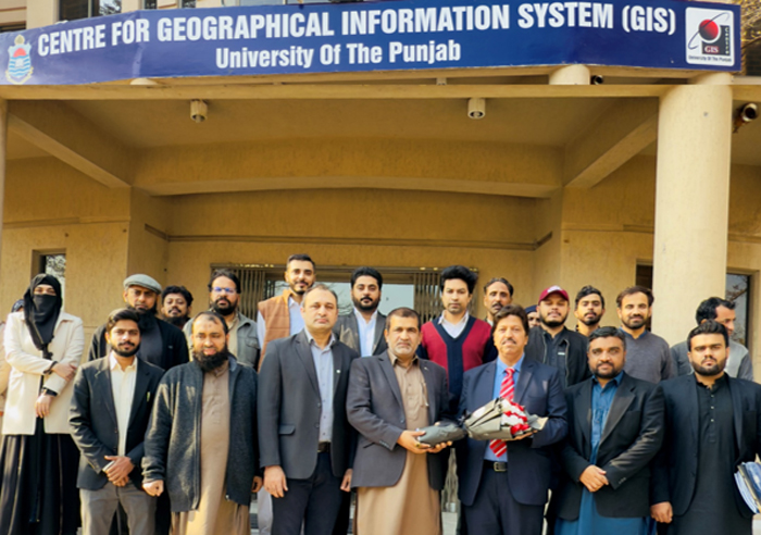
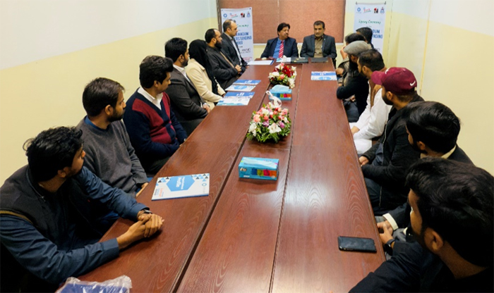
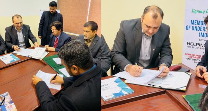
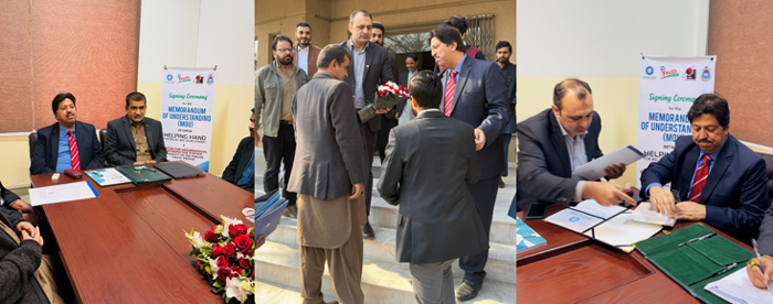
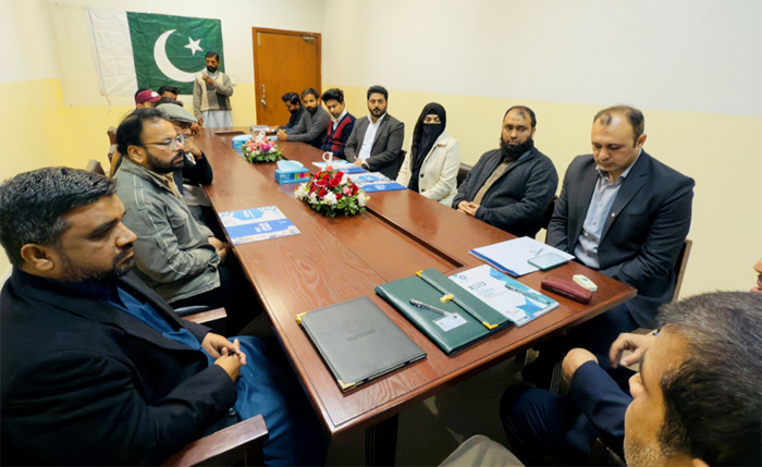
The Memorandum of Understanding (MoU) was signed on Jan 23, 2025, and hosted by Smart Sensing for Climate and Development (SCD) at the Centre for Geographical Information System (CGIS), University of the Punjab, Lahore, Pakistan. Attendees included Sajid Ali Chadhar, Director of Operations at HHRD Pakistan; Touseef Sardar Awan, Regional Head of HHRD Central Punjab and Focal Person; Khushal Shaheen, Project Coordinator of the Orphan Support Program at HHRD; and Sultan Mahmood from the Youth Empowerment Program at HHRD Lahore. They discussed the scope of mutual collaboration. Prof. Dr. Shahid Ghazi, Director of CGIS, and Dr. Sawaid Abbas, Assistant Professor at CGIS, along with other faculty members, including Dr. Samawia Rizwan, Fahad Bilal, Uzair Mahmood, Muhammad Waqas, Arslan Qasir, and Khushal Noon, Niaz Ahmad were also present at the event. |
|
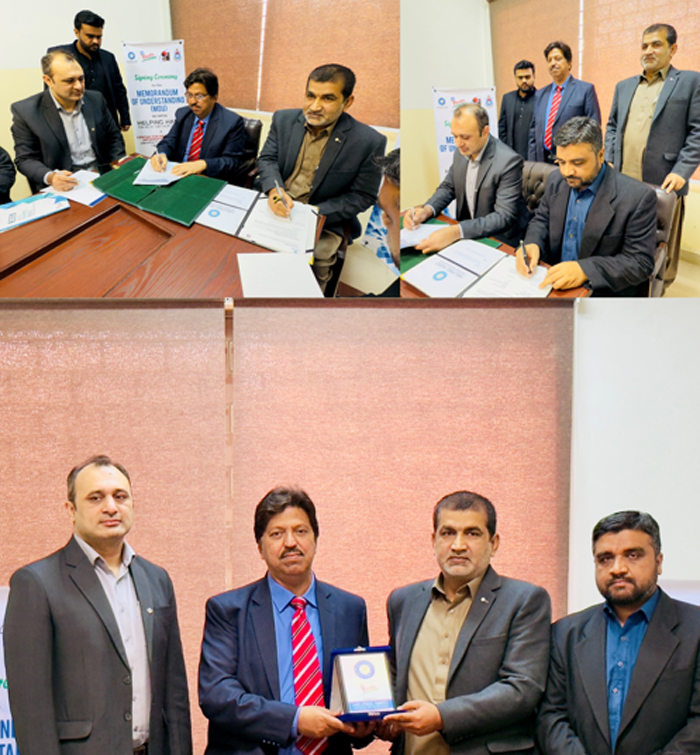
Prof. Dr. Shahid Ghazi emphasized the research group's achievements and ongoing initiatives in the region, recognizing this collaboration as a significant step toward a broader and more impactful partnership. He commended the initiative as a foundation for long-term cooperation and meaningful progress. The MoU was signed by Sajid Ali Chadhar, Director of Operations at HHRD Pakistan, and Prof. Dr. Shahid Ghazi, Director of CGIS. Additionally, Touseef Sardar Awan, Regional Head of HHRD Central Punjab, and Dr. Sawaid Abbas, Assistant Professor at CGIS, signed the MoU as Focal Persons, reaffirming their commitment to fostering collaboration and advancing shared objectives. |
|
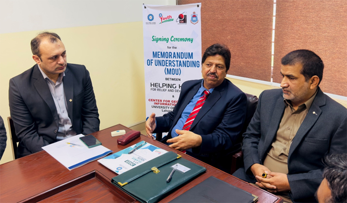
Sajid Ali Chadhar from the Director of Operations, HHRD Pakistan emphasized the partnership between CGIS-PU and HHRD in youth and volunteer development, highlighting their commitment to engaging volunteers in events, programs, and fieldwork with prior approval. He stressed the inclusion of partner organizations in seminars, workshops, and training sessions through mutual agreement while ensuring a safe environment for interns and students. He also reaffirmed HHRD’s support for infrastructure development at the Smart Sensing for Climate and Development Lab at CGIS and its commitment to training professionals to enhance climate policies and disaster mitigation efforts. |
|
Dr. Sawaid Abbas presented the Smart Sensing for Climate and Development initiatives, highlighting ongoing research activities and success stories. In his remarks, he emphasized broader relationships between the two institutions. He elaborated on key areas of collaboration, including community services, orphan scholarships, GIS-based disaster response, and using GIS evidence to assess and enhance relief activities. He also stressed the significance of disaster management scholars in strengthening research and practical applications in crisis situations. Additionally, he underscored the role of training and workshops in equipping students and professionals with the necessary skills to contribute effectively to humanitarian and environmental initiatives. |
|
| Strategic Objectives and Collaboration |
This MoU establishes a collaborative framework between HHRD and CGIS-PU, focusing on mobilizing and training youth volunteers from CGIS-PU for community service while also fostering cooperation in remote sensing, GIS, and environmental monitoring. This partnership aims to enhance capacity building, share knowledge, and promote joint research projects that leverage the strengths of both institutions. By combining expertise in geospatial technologies with community-driven initiatives, the MoU seeks to create meaningful opportunities for students and researchers while contributing to sustainable development and disaster response efforts. |
|
| Implementation and Coordination |
A Joint Steering Committee will be established to oversee the implementation of the MoU, ensuring effective collaboration between HHRD and CGIS. The committee will include representatives from both organizations, who will convene at least twice a year to review progress, address challenges, and plan future initiatives. To facilitate seamless communication and coordination, each party will designate a primary point of contact, ensuring that the objectives of the MoU are met efficiently and that all collaborative efforts remain aligned with mutual goals. |
|
|